![]()
Sault Ste Marie is at the juncture of Lake Superior and Lake Huron, just above Lake Michigan and right on the US and Canadian Border.
On arrival we stayed on the US side, then moved over to the Canadian side for the 4th of July fireworks where we joined the Canadians to watch the show on the US side. While here we got organized for our Canadian visit arranging for wireless internet service, customs and currency.
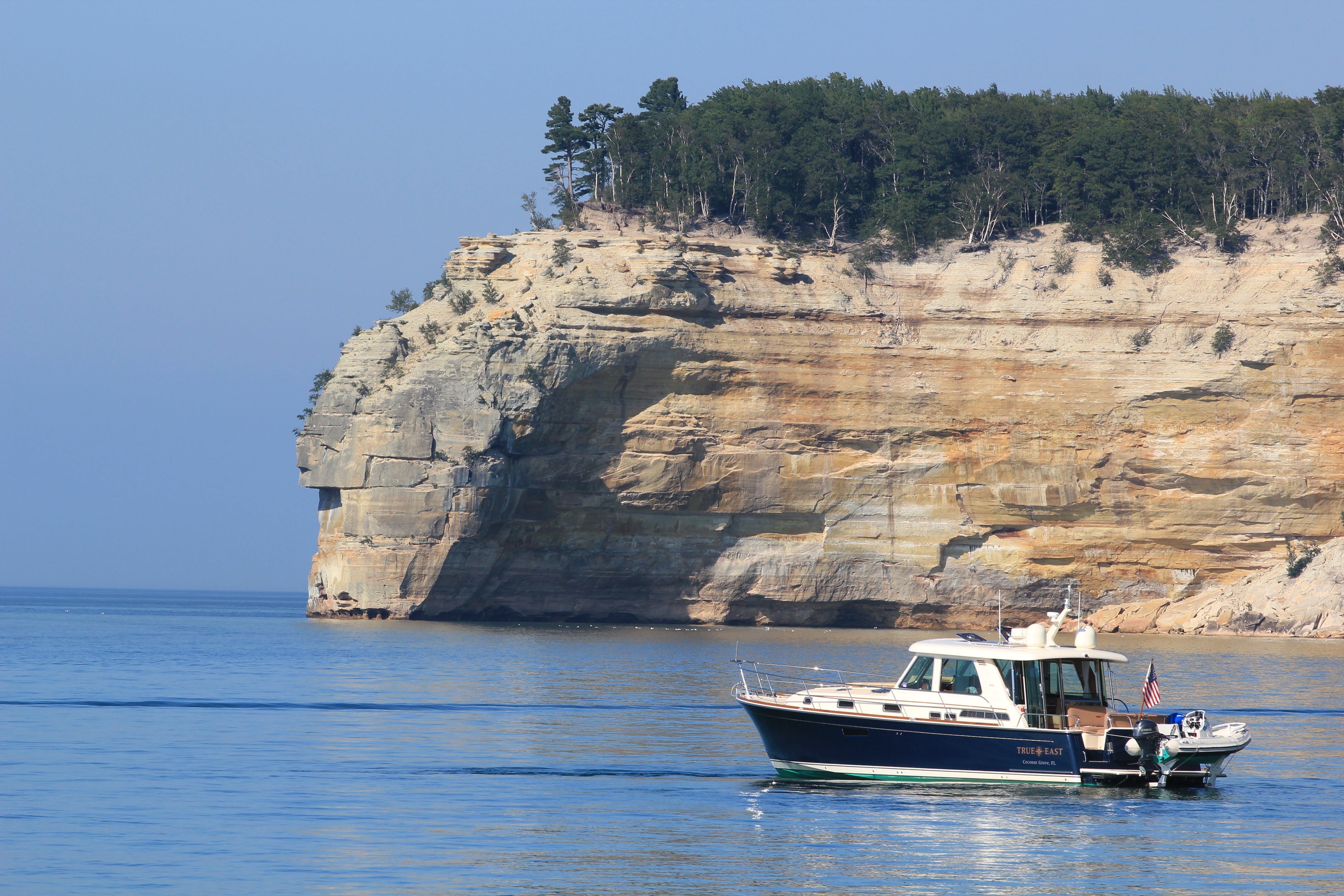
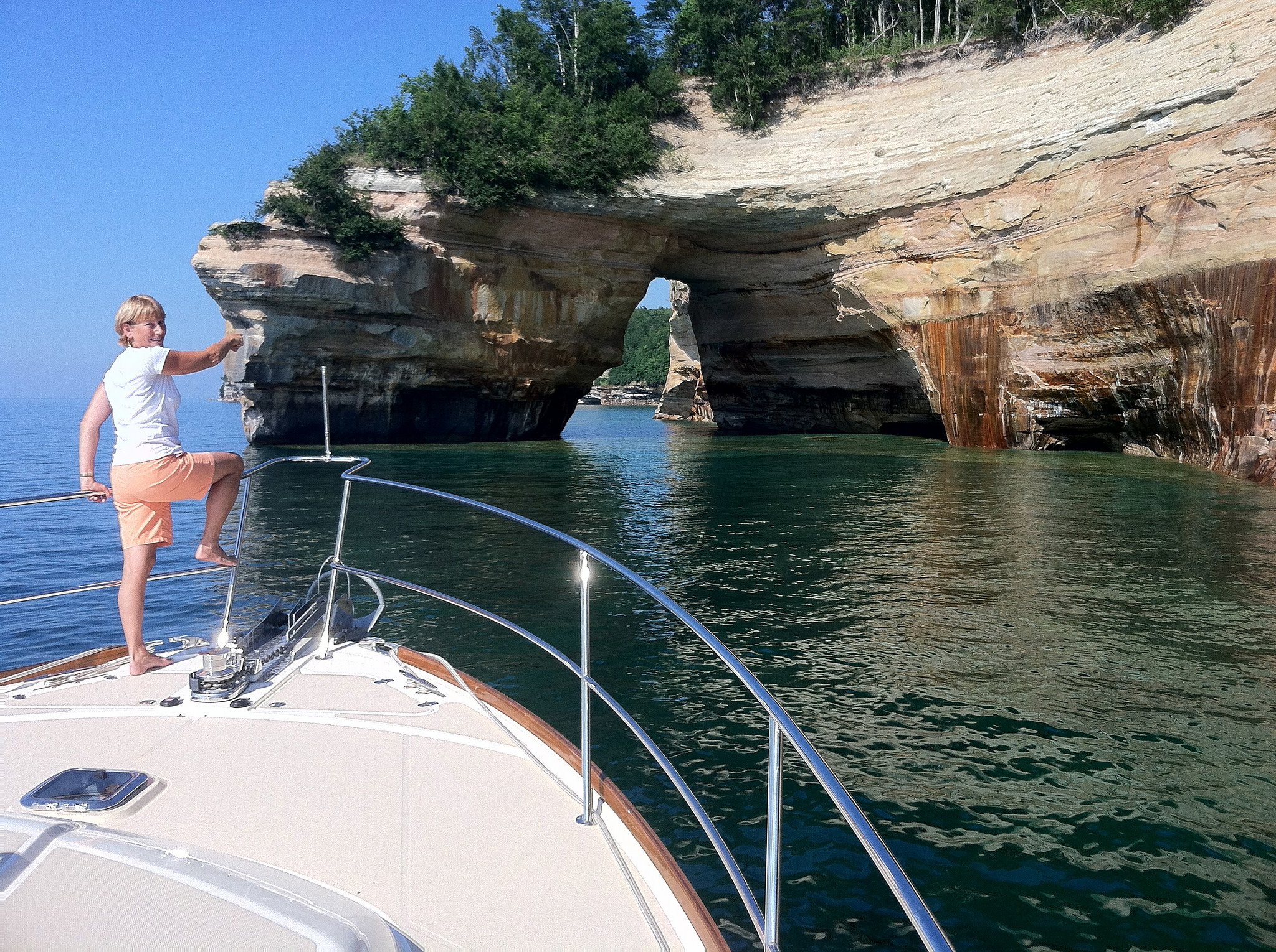
Our first journey took us west up thru the Canadian lock into Lake Superior. After the lock we set course to the north side of lle Parisienne Island…not much to see except a huge wind farm on the Canadian side of the lake. On the the south side of the lake with a stop at Grand Marais for lunch while anchored up. As we headed further west to Munising, we encountered the magnificent Pictured Rocks National Lakeshore Park. Towering clifts with many minerals leaching their colors on the rock. Crystal clear water with huge round boulders 15 feet deep that appeared as they where 3 feet. We have included a separate set of photos of this wonderful place. At Munising, we got to see another fireworks display as they were rain delayed…by far the best small city show ever.
On the return we stopped overnight at Whitefish bay and met another very enthusiastic Sabre owner. We cleared customs again at Sault St Marie and headed staight up to Lake George where we anchored off Squirrel Island. This was the start of our jouney down the North Channel. For us, one of most beautiful parts of the trip. 150 miles of weaving our way thru narrow, rocky channels…..a bit like Maine without salt, lobster pots or people. Stopping along the way to play some great little golf courses with Lola in tow most of the time. In addtion to following the small boat channel down the north side, we took a side trip over to Manitoulin Island, the largest island on a fresh water lake in the world.
Little Current and Detroit Narrows are the dividing line between the North Channel and Georgian Bay. The small boat channel is suppost to be limited to boats under 40′, a number of times we were glad not to be meeting ourselves coming the other way. Georgian Bay is filled with inumerable islands each with a single cottage and small boat dock. Again very Maine like with long and deep peninsulas with a wooded rocky shore line. Georgian Bay was almost a separate Great Lake with the Bruce Peninsula forming the south side of the Bay. From the Bad River, we took a staight shot over to Tobermory. This is very popular town with some nice galleries and a friendly golf course.
As we moved east toward the influence of Toronto, the development got more intense and the boats more numerous. By the time we got to Midland, the place was thick with boats, but few venture very far from home and most found our trip to be beyond their comprehension.